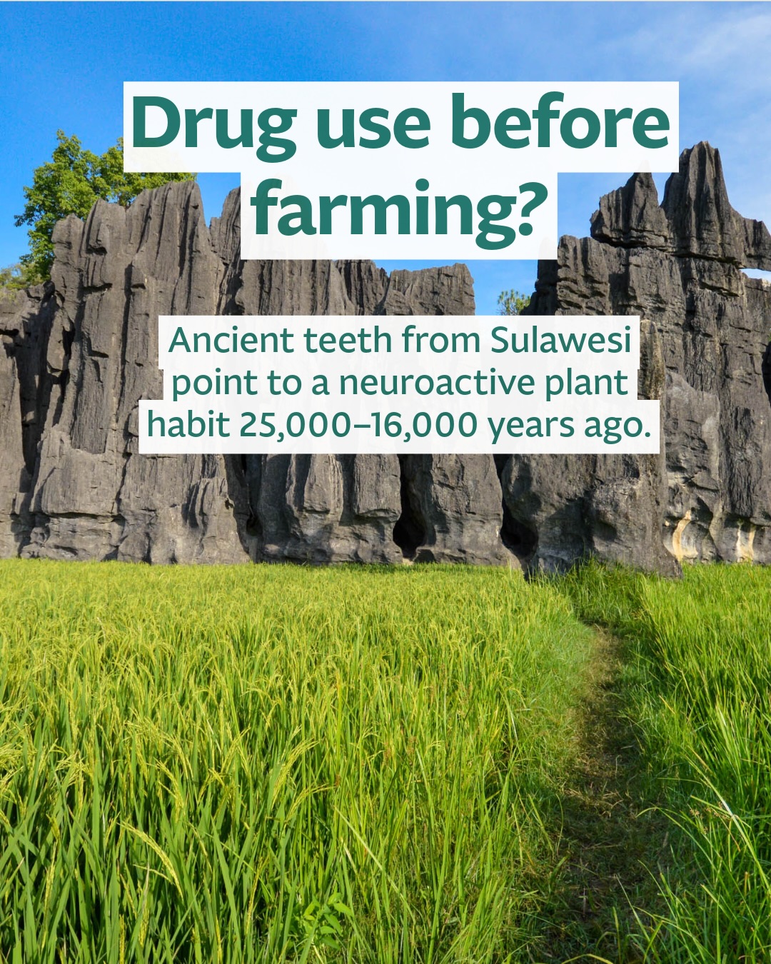

• People in Sulawesi may have been habitually using a neuroactive plant as far back as 25,000–16,000 years ago.

A new study in Science Advances examines two preagricultural foragers from South Sulawesi, Indonesia, separated by thousands of years but sharing an unusual dental pattern: deep, rounded, circumferential wear that does not match ordinary chewing. The researchers argue that the wear formed through repeatedly holding, sucking or gently gnawing a small, hard object in different parts of the mouth. 

Using LC-MS, the team detected arecoline—a characteristic alkaloid of areca, or “betel”, nut—in dental samples from both individuals. One came from Leang Bulu Bettue and dates to 25–16 ka; the other, from Leang Cappalombo 1, is associated with deposits dating to around 7.6–6.3 ka. 

This was probably not betel chewing in the form familiar today. Modern betel quid typically combines processed areca nut with slaked lime and other ingredients. To test whether a simpler practice was plausible, the researchers soaked intact areca nuts and applied the resulting solutions to cells expressing human receptors. The experiments showed that intact nuts could release physiologically active arecoline without slaked lime. Combined with the dental wear, chemical residues and experiments support the authors’ interpretation that these foragers habitually sucked whole areca nuts.

For now, the sample is just two individuals, and psuggestions that the nuts were used for stimulation, pain relief or medicinal purposes remain hypotheses. What the study does show is that habitual neuroactive plant use may reach far deeper into the hunter-gatherer past than the archaeological record had previously demonstrated. 

Reference
Brumm et al. 2026. “Betel nut sucking is the earliest recorded evidence for the habitual use of a neuroactive plant drug.” Science Advances.
10.1126/sciadv.aei1901

#SoutheastAsianArchaeology #Sulawesi #IndonesiaArchaeology #Prehistory #BetelNut
  • Twenty-two small beads can preserve the traces of a much larger world of movement and exchange.

A new archaeometric study examines beads excavated in 2023 at Khok Phithak, within the ancient city of Khu Bua in Ratchaburi, central Thailand. Khu Bua was an important urban centre associated with the Dvaravatī cultural sphere, enclosed by earthen ramparts and moats and situated within the Mae Klong river system. 

The researchers analysed 21 glass beads and one chalcedony/agate bead, combining microscopic observations with VP-SEM-EDS, LA-ICP-MS and micro-Raman spectroscopy. Manufacturing traces—including axial colour streaks and elongated bubbles—indicate that most of the glass beads were made by drawing glass into tubes or canes before cutting them into individual beads. 

Their chemistry indicates that nineteen beads belong to the m-Na-Al-1 glass subgroup, consistent with glassmaking traditions documented in South Asia, particularly the wider technological sphere of southern India and Sri Lanka. Together with their manufacturing technique, the authors associate these beads with the large-scale Indo-Pacific beadmaking tradition. 

However, one blue bead, B014, is made from plant-ash soda–lime glass with a broad western Asian affinity—although the study cannot identify a specific production centre. Another remarkable bead, B007, appears to have been wound from recycled iron-smelting slag, suggesting an entirely different production history.

Rather than evidence for primary glassmaking at Khu Bua itself, the authors interpret the assemblage as reflecting an inland centre of consumption and possibly redistribution, connected through maritime and riverine networks to much wider systems of Indian Ocean exchange. 

Reference
Risteka et al. 2026. “Production Technology and Provenance of Dvaravatī Glass Beads from Khu Bua, Central Thailand: An Archaeometric Study.” Heritage 9, 347.
10.3390/heritage9090347

#SoutheastAsianArchaeology #ThailandArchaeology #Dvaravati #KhuBua #ancienttrade
  • Small finds, big stories this week.⠀
⠀
The latest Southeast Asian Archaeology newsletter focuses on Thailand, with newly reported rock art, worrying news of looting, and two new papers showing what archaeological science can reveal from humble materials.⠀
⠀
One study looks at prehistoric pottery from Don Up Mung in Nong Bua Lamphu, tracing differences in clay composition, firing and production choices. Another follows glass beads from Khu Bua in Ratchaburi into the wider world of South Asian glassmaking and Indian Ocean exchange.⠀
⠀
Also: a LOT of opportunities this week — jobs, scholarships, courses and calls for papers.⠀
⠀
Link in bio⠀
⠀
#SoutheastAsianArchaeology #Archaeology #CulturalHeritage #ArchaeologicalScience
  • Can inscriptions help reconstruct how a kingdom expanded across a landscape?

King Citrasena (Chitrasen, later known as Mahendravarman) ruled Chenla in the late 6th to early 7th centuries, during a period when Chenla’s influence was extending across parts of what are now Cambodia, Laos and northeastern Thailand. His reign is known partly through inscriptions recording religious foundations, royal achievements and other acts of authority. 

Pailoplee and Khatshima map 21 inscriptions from at least 19 locations associated with Citrasena, and asked if people were moving between these places, which routes would they have taken? To explore this, they use Least Cost Path (LCP) modelling in a GIS. LCP calculates routes that minimise the “cost” of movement across terrain.

In archaeology, this can help identify plausible corridors shaped by features such as slopes, river valleys and mountain barriers. These models show how movement could have been structured by the landscape under the assumptions of the model.

Across several scenarios, the reconstructed paths repeatedly concentrate around major river systems—especially the Mun River—and particular passes through the Phnom Dong Rek (Dangrek) mountain range. The authors also compare the modelled network with archaeological sites attributed to Citrasena’s period, many of which fall along these reconstructed corridors.

Where river navigation would have been difficult (such as the Khone Phapheng Falls), the authors propose that Citrasena’s forces may instead have moved overland along riverbanks, using waterways as natural guides through the landscape.

The placement of several inscriptions near river confluences also suggests that these locations may have been important for controlling movement, communication and exchange, not simply access to water.

Reference
Pailoplee, S. & Khatshima, K. 2026. “The role of King Chitrasen (Mahendravarman) in the expansion of the Chenla Kingdom: A study of inscriptions and historical geography.” Social Sciences & Humanities Open 14, 103503.
10.1016/j.ssaho.2026.103503

#SoutheastAsianArchaeology #Cambodia #Thailand #Laos #Chenla
  • Sometimes the biggest archaeological questions depend on evidence we cannot see during excavation.

Microarchaeology investigates archaeological deposits at microscopic and microstratigraphic scales. In Southeast Asia, this can be especially valuable because monsoonal wetness, tropical weathering, intensive land use and complex depositional histories can affect how archaeological evidence survives. 

Researchers can examine the surrounding sediment for traces of past activity and later disturbance. Methods discussed in this new paper include sediment micromorphology, laboratory micro-excavation, high-resolution imaging, FTIR microscopy and SEM-EDS. Depending on the context, microscopic evidence can help identify burning, trampling, plant processing, sediment movement and environmental change. 

The importance of that context is illustrated by work in northern Laos. At Tam Ngu Hao 2, microstratigraphy was used alongside lithological observations and dating to establish the stratigraphic context of Denisovan fossil evidence. At Tam Pà Ling, it has shown potential for investigating environmental seasonality and possible patterns of early modern human presence. These methods help archaeologists understand what happened to a deposit before drawing conclusions from what it contains.
 
The paper also introduces the Australian Microarchaeology and Palaeosciences Facility (AusMAP) and argues for greater collaboration, training and locally based microarchaeological expertise across Southeast Asia. 

Reference:
Hernandez et al. 2026. Scaling down to look further back: Southeast Asia, deep-time science and microarchaeology. SPAFA Journal 10.
10.26721/spafajournal.651369a4y8 

#SoutheastAsianArchaeology #Archaeology #Microarchaeology #Geoarchaeology #ArchaeologicalScience
  • This week on Southeast Asian Archaeology: claims, contexts and careful reading.⠀
⠀
With Malaysia’s National Day, Vietnam’s National Day, Timor-Leste’s Popular Consultation Day, and International Literacy Day all close together, I’m thinking about literacy not just as reading words, but reading evidence: museum labels, old spellings, dates, maps, artefacts, archives, and the occasional viral post with a raised eyebrow.⠀
⠀
The catalyst this week is the recent controversy over historical claims in Malaysia, alongside a timely RSIS piece on how historians, archaeologists, archivists, librarians and curators can help push back against disinformation. Not by attacking people, but by helping everyone ask better questions of the past.⠀
⠀
Also in this week’s issue: Penang’s historical Malay spellings, Cambodia’s new artefact database grant, Singapore’s revised History Gallery, UNESCO’s maritime museum project, new research on Sundadonty, Roti Island, Chenla inscriptions, ancient Myanmar, and more.⠀
⠀
Link in bio.⠀
⠀
#SoutheastAsianArchaeology #Archaeology #Heritage #InformationLiteracy
  • How old are the rock paintings of Mainland Southeast Asia? 🎨🪨

A new study from Mangguan in Yunnan, southwestern China, provides another important piece of the puzzle.

Using uranium-thorium dating, researchers analysed tiny calcite deposits that had formed over the paintings. Because the calcite must be younger than the pigment underneath, the dates provide a minimum age for the art. One deposit covering a human figure shows that the painting was already there at least 4,220 years ago.

Mangguan is particularly interesting because it lies only about 15 km from the better-known Cangyuan rock art complex. The two have stylistic similarities and overlapping dates, suggesting they formed part of a broader regional rock art tradition, a comparison can be taken farther south.

The rock paintings at Pha Taem in Luang Prabang, Laos, have previously been compared with Cangyuan, raising intriguing questions about relationships between the rock art traditions of southwestern China and Mainland Southeast Asia.

Most rock art in Mainland Southeast Asia remains poorly dated, so dates like those from Mangguan give us increasingly useful chronological anchors for thinking about these connections.

References:
Wu, Y. et al. 2026. U-Th dating of rock paintings in southwestern China: minimum age of ~4.2 ka BP at the Mangguan site. Journal of Archaeological Science: Reports 74, 105987. DOI: 10.1016/j.jasrep.2026.105987.

Bo, X. 2020. On the relationship between the Cangyuan rock art in Yunnan, China, and the Pha Taem rock art in Laos. Rock Art Research 37(2).

Tan, N.H. 2018. The Cliff Paintings of Pha Taem, Luang Prabang, Lao PDR. Rock Art Research 35(1).

#RockArt #SoutheastAsianArchaeology #Yunnan #China
  • Extraordinary claims about the past can be exciting. But how do we tell an exciting new hypothesis from pseudoarchaeology?

Recent controversy in Malaysia over claims that ancient Malays taught the Romans shipbuilding provides a useful case study. Rather than piling on the person behind the claims, I think there is a more useful question to ask: how would we actually test an idea like this?

Archaeology gives us some simple tools.

Do the dates work? What is the primary evidence? Does the evidence actually demonstrate the connection being claimed? Are there better explanations? And perhaps most importantly: what evidence would make us reject the hypothesis?

Ancient Southeast Asians really were sophisticated seafarers. Srivijaya really was one of Asia’s great maritime powers. Sungai Batu really does preserve remarkable evidence for early iron production.

None of those achievements needs embellishment to make Southeast Asian archaeology extraordinary.

Swipe through for five questions you can use the next time you encounter an astonishing claim about the ancient past.

🚩 Remember: possibility is not evidence, similarity does not necessarily mean transmission, and extraordinary claims still have to survive ordinary archaeological scrutiny.

Read more about the archaeology behind these claims in this week’s Southeast Asian Archaeology Newsletter.

#SoutheastAsianArchaeology #Pseudoarchaeology #Malaysia #MaritimeArchaeology #MediaLiteracy
  • A 4,000-year-old painted stone from Wetar Island may change how we understand the Austronesian story.⠀
⠀
Archaeologists excavating Huknaur 1 in Southeast Indonesia found a painted plaque with a red sun-ray motif linked to the Austronesian Painting Tradition — a wider visual tradition known from eastern Indonesia and nearby islands.⠀
⠀
What makes this find so important is that the plaque appears to be older than the first pottery at the site. That means a shared symbolic tradition may have been present before the full Neolithic package usually associated with Austronesian expansion. This discovery suggests that ideas, symbols, and identity may have travelled ahead of pottery.⠀
⠀
It is a reminder that the spread of people goes beyond tools, crops, or ceramics, and may also have been about belief, belonging, and a shared visual language carried across the sea.⠀
⠀
Swipe through to see why this small object has such big implications.⠀
⠀
Reference:⠀
O’Connor, S., Kealy, S., Kaharudin, H.A.F., et al. (2026). 4000-year-old painted plaque from Southeast Indonesia reveals Austronesian Painting Tradition preceded Neolithic pottery. PNAS 123(34): e2611580123.⠀
⠀
#SoutheastAsianArchaeology #RockArt #Austronesian #Indonesia #Wetar #SoutheastAsia #IslandSoutheastAsia #AustronesianPaintingTradition
  • Plaques, Ponds and Provenance⠀
⠀
This week’s newsletter begins with a 4,000-year-old painted plaque from Wetar Island — a small object with a big story.⠀
⠀
The plaque carries a red sun-like motif linked to the Austronesian Painting Tradition, and it appears before pottery at the site. That suggests visual symbols and shared ideas may have moved through maritime Southeast Asia before some of the usual archaeological markers we associate with Austronesian expansion.⠀
⠀
Also this week: archaeology beneath Angkor’s Sras Srang, suspected Ban Chiang artefacts offered for return from Switzerland, and more heritage news from across the region.⠀
⠀
Link in bio.
Tuesday, September 15, 2026
Southeast Asian Archaeology
  • News
  • Resources
  • Countries
    • Southeast Asia
    • Mainland Southeast Asia
      • Cambodia
      • Laos
      • Malaysia
      • Myanmar
      • Thailand
      • Vietnam
    • Island Southeast Asia
      • Brunei
      • Indonesia
      • Malaysia
      • Philippines
      • Singapore
      • Timor Leste
    • Peripheral Southeast Asia
  • Topics
    • Artifact Type
      • Architecture
      • Bones and Burials
      • Ceramics
      • Intangible Cultural Heritage
      • Lithics
      • Megaliths
      • Rock Art
      • Sculpture
    • Field
      • Anthropology
      • Bioarchaeology
      • Epigraphy
      • General Archaeology
      • Metallurgy and Metalworking
      • Paleontology
      • Underwater Archaeology
      • Visual Art
      • Zooarchaeology
    • Other Themes
      • Animism
      • Buddhism
      • Christianity
      • Disaster Risk Management
      • Hinduism
      • Islam
      • Archaeological Tourism in Southeast Asia
  • Visit
    • Virtual Archaeology
    • Unesco World Heritage
  • Jobs
  • Subscribe
  • About
    • About
    • Supporters
    • Terms of Use
    • Privacy Policy
    • Contact
No Result
View All Result
Southeast Asian Archaeology
  • News
  • Resources
  • Countries
    • Southeast Asia
    • Mainland Southeast Asia
      • Cambodia
      • Laos
      • Malaysia
      • Myanmar
      • Thailand
      • Vietnam
    • Island Southeast Asia
      • Brunei
      • Indonesia
      • Malaysia
      • Philippines
      • Singapore
      • Timor Leste
    • Peripheral Southeast Asia
  • Topics
    • Artifact Type
      • Architecture
      • Bones and Burials
      • Ceramics
      • Intangible Cultural Heritage
      • Lithics
      • Megaliths
      • Rock Art
      • Sculpture
    • Field
      • Anthropology
      • Bioarchaeology
      • Epigraphy
      • General Archaeology
      • Metallurgy and Metalworking
      • Paleontology
      • Underwater Archaeology
      • Visual Art
      • Zooarchaeology
    • Other Themes
      • Animism
      • Buddhism
      • Christianity
      • Disaster Risk Management
      • Hinduism
      • Islam
      • Archaeological Tourism in Southeast Asia
  • Visit
    • Virtual Archaeology
    • Unesco World Heritage
  • Jobs
  • Subscribe
  • About
    • About
    • Supporters
    • Terms of Use
    • Privacy Policy
    • Contact
No Result
View All Result
Southeast Asian Archaeology
No Result
View All Result
ADVERTISEMENT

Related Posts

Source: The Collector 20240726

Debunking the Myth: Angkor Was Never a Lost City

29 July 2024
0
130

...

Source: DAP News 20240723

APSARA Authority Uncovers Angkorian Iron Smelting Site on Phnom Bok

26 July 2024
0
36

...

Source: Khmer Times 20240708

Preah Vihear Commemorates 16 Years of World Heritage Status

18 July 2024
0
22

...

Source: UNESCO 20240620

Koh Ker Temple: Four-Legged Heroes Clear Landmines

1 July 2024
0
50

...

Popular This Week

  • Southeast Asian Archaeology memes that will tickle your funny bone and also make you ponder

    Southeast Asian Archaeology memes that will tickle your funny bone and also make you ponder

    68 shares
    Share 68 Tweet 0
  • Southeast Asian Archaeology from a Rock Art Perspective (with annotations)

    0 shares
    Share 0 Tweet 0
  • The most influential books on Southeast Asian Archaeology (a crowdsourced list)

    0 shares
    Share 0 Tweet 0
  • Negritos or Malays: Who are the original inhabitants of the Philippines?

    2 shares
    Share 2 Tweet 0
  • An archaeological region older than Angkor Wat

    1 shares
    Share 1 Tweet 0
Buy me a coffeeBuy me a coffee

If you found this site useful, you can help support it by buying me a coffee!

Preah Vihear: An Overview

23 May 2008
in Cambodia, Thailand
Tags: Angkor (kingdom)border disputePreah Vihear (province)Preah Vihear (temple)Preah Vihear border disputeSisaket (province)Suryavarman I (person)Suryavarman II (person)
0
SHARES
432
VIEWS

Bangkok Post carried a feature yesterday about the history of the disputed Preah Vihear temple as well as a history of the dispute.
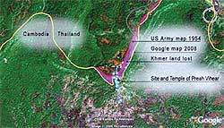
Preah Vihear Map, Bangkok Post 22 May 2008

A Fine Line
Bangkok Post, 22 May 2008

A fine line
The sovereignty dispute over sacred site Preah Vihear continues
STORY BY PICHAYA SVASTI, PHOTOS COURTESY OF MUANG BORAN PUBLISHING HOUSE

Forty-six years ago, the World Court ruled that Preah Vihear, or Prasat Phra Viharn, is under Cambodian sovereignty.

But the significance of Preah Vihear lies beyond the tug-of-war match that Thailand and Cambodia have engaged in over it. The ancient temple is an historical symbol of interrelationships among different peoples and beliefs. It also represents a social and cultural history of mankind.

“Preah Vihear belongs to neither Cambodia nor Thailand – it belongs to sacred powers. It has been a holy place for pilgrimage,” said anthropologist and archaeologist Srisakra Vallibhotama.

According to him, Preah Vihear, or Sri Sikharesvara, has been an area for people from both sides to perform rituals.

Watershed lines were traditionally considered by ancient people as no man’s land, belonging to no one. Crossing the areas required the performing of rituals.

Established in the reign of Cambodian King Yasovarman (889-900) under the Devaraja (divine kingship) Cult, Preah Vihear stands on the Peuy Ta Di cliff of the Phra Viharn Mountain. The mountain is part of the Phanom Dong Rek Range that lies between the Lower Khmer Plain and the Korat Plateau.

Those who wanted to cross the Lower Khmer Plain and the Korat Plateau needed to perform or attend rituals. Sanctuaries were built as homes to spirits called Phi Ton Nam (watershed spirits) and also served as unofficial border posts.

In ancient times, kings and peoples paid homage to the spirits there. Phra Viharn Mountain was believed to be home to Phi Ton Nam and then to a god who safeguarded local people.

Historian Dhida Saraya writes in the book Preah Vihear (Sri Sikharesvara) that the Khmer kings built the sanctuary, but the sanctuary embraces different peoples and different beliefs. Hence, the true meaning and significance of Phra Viharn mountain is universal.

Prasat Phra Viharn, as a pilgrimage site, has been a universally and internationally sacred place. Several great Khmer kings established there the power of Shiva, the Universal God, over the local deities and ancestors of the peoples.

According to her book, during the reign of King Suryavarman I (1010-1050), ancestral worship and animism were central beliefs of the Devaraja Cult. The king established a link between himself, as the God King, and Sri Sikharesvara of Phra Viharn Mountain.

King Suryavarman II (1113-1150) extended and centralised the Sri Sikharesvara Sanctuary, making the temple the core of the state cult, the Devaraja, and the ritual centre of ancestral worship.

It became customary to pay homage ceremonially to the Kamaratengjagata Sri Sikharesvara at the same time the farmers celebrated their annual festival.

According to Srisakra, people from both sides came to Preah Vihear to perform rituals, as they do to this very day. Therefore, he wonders why France believed the sanctuary belonged to Cambodia.

“The troublemaker was France, as they introduced the concept of borders. Ancient people just looked for a symbol before crossing from one zone to another but France drew the line for us to accept,” the archaeologist said.

To survive colonisation, Siam opted for Western knowledge and, hence, fell into the trappings of thoughts and theories set by the superpowers.

As long as Thailand sanctions France’s interpretation that any site with Khmer inscriptions belongs to the ancient Khmer empire, there will be no solution, he noted.

“It was France who started circulating the story that Angkor was the centre of civilisation and any land with Khmer inscriptions was under the Khmer empire. This model was created by France and accepted by us,” the academic added.

According to him, English professor O. W. Wolters at Cornell University, New York, analysed inscriptions and found that Southeast Asian empires were not centralised states but were instead regulated under the Mandala system that observed Indian traditions. They were a network of big and small regions which revered the king of kings, known as Jakrapatdiraj or Rajathiraj.

Siamese kings loved Laotian and Khmer royals like their own relatives and some Cambodian kings were educated in the Siamese court.

“In fact, the Thai-Khmer relations were not heirarchical but were instead based on intermarriage,” he noted.

However, imperialist countries ignored the Mandala system in this region and introduced European-style political and administrative structures to manipulate the Asian royals and the elite class.

They also exercised another tool – border demarcation – during conflict with other Southeast Asian countries. Maps became major evidence for making agreements or claims under laws, Srisakra said.

He pointed out that Thailand lost Preah Vihear to Cambodia because Siam had recognised the French map, which drew the sanctuary within Cambodian.

In 1904, Siam failed to send representatives to border demarcation surveys conducted by France. This allowed France to include Phra Viharn in the map, made by France and Cambodia, which was shown to Siam in 1907, even though it went against the principle of watershed lines.

Based on the watershed line theory, Phra Viharn Mountain lies on Thai territory. According to the French map, the mountain is located within the Cambodian border.

To prove that the Phra Viharn sanctuary compound, from the foot of the mountain to the top, is in Thai territory, just pour water from the top of the mountain and see on which side it drains. The fact is that the water flows towards Korat Plateau and to the Lam Trao reservoir in Si Sa Ket, Srisakra noted.

In 1959, Cambodia took the dispute to the World Court. It presented the map charted by France under the Treaties of 1904 and 1907 as major evidence.

Another substantial piece of evidence was a group photo of the French Governor of Kampongthom, some French officials in uniform and Siam’s Prince Damrong, standing near a French flag being flown at full mast in the Phra Viharn compound. In 1929, Prince Damrong, then the president of the Royal Academy and a former interior minister, visited a number of historical sites in Si Sa Ket, including Prasat Phra Viharn.

On June 15, 1962, the World Court ruled that the ruins of Prasat Phra Viharn are under Cambodian sovereignty on the grounds that Thailand never lodged a protest against the said map. Nevertheless, the court ruling left some room for argument on the surrounding land where the border was not settled.

In his interview with Matichon Daily on January 9, 1992, MR Seni Pramoj, the lawyer who handled the case for Thailand, said, “There is still some misunderstanding that the whole Phra Viharn Mountain belongs to Cambodia. This is not so. The World Court did not pass such a judgement. The World Court only passed a decision to return the right of possession over the sanctuary and the surrounding area, not the whole mountain.”

The controversy erupted again after Cambodia, during last year’s Unesco conference in New Zealand, lodged a motion to nominate Preah Vihear as a new World Heritage site. Until now, the nomination has been deadlocked. However, a decision is expected from the World Heritage Committee within the next month.

Tharapong Srisuchat, director of the Fine Arts Department’s Office of Archaeology, said the Thai side is trying, through diplomatic procedures, to push for mutual collaboration in nominating Preah Vihear as a World Heritage site because the World Court’s ruling covers only the sanctuary, not the mountain.

According to him, each World Heritage site must consist of its nucleus, core zone and buffer zone, which should be circular, but Preah Vihear in Cambodia’s proposal is in the shape of a fan with the core zone at its lowest end.

The temple’s surroundings located in Thai territory, including the site of ancient communities at the foot of the Phnom Dong Rek mountain range, stone carvings on the Pha Mor I-Daeng cliff, stone-cutting sources and the Sa Trao reservoir, are also important and should go together with the sanctuary in the nomination.

He pointed out that Cambodia’s attempts to register only the sanctuary could damage the historical value of Preah Vihear and spoil management plans.

However, Thai authorities and scholars are still hoping for a happy ending.

Srisakra suggested Thailand to negotiate with Cambodia for the declaring of the disputed area as a no man’s land and the sharing of benefits if it becomes a World Heritage site.

“Thailand must be ready to discuss the matter, and have enough evidence to show that Preah Vihear cannot be an outstanding World Heritage site without its surroundings,” he said.

CHRONOLOGY OF EVENTS RELATING TO THE PREAH VIHEAR DISPUTE

1833 to 1846Siam and Vietnam were engaged in a 14-year war known as the Annam-Siam War, resulting in Siam reasserting sovereignty over Cambodia. In the early Bangkok Period, Cambodia had been under Thai control. During the reigns of King Rama III and IV, Siamese kings crowned Cambodian kings.

1861France ruled over Saigon and South Vietnam, and became interested in Laos and Cambodia.

December 7, 1863A treaty was signed between Siam and Cambodia, verifying Cambodia’s status as a dependent state of Siam.

France invited Siam to attend the coronation of Prince Narodom.

1867Siam and France signed an agreement that all of Cambodia, except for Seam Reap, Battambong and Srisophon, was under French protection.

1893France seized the east bank of the Mekong River and forced Siam to sign a pact granting possession.

1907Siam and France signed another treaty under which Siam had to yield the right of possession over Seam Reap, Battambong and Srisophon to France in exchange for the re-acquisition of Dan Sai, Trat and all islands ranging from Laem Ling to Kood Island.

1929Prince Damrong visited a number of historical sites in Si Sa Ket. At Prasat Phra Viharn, he was welcomed by the French Governor of Kampongthom and some French officials in uniform. A French flag was raised in the compound. This incident was later claimed as evidence in World Court.

1939Luang Vichitr Vadakarn, the director-general of the Fine Arts Department, inspected the map of the area and discovered that a stream, instead of the watershed line, was used as the boundary. The government, headed by Field Marshall Plaek Pibulsonggram, tried to reach agreement with the French government in Indochina. The Thai government made an announcement and openly put the area under its protection on October 11, 1940.

1940The Fine Arts Department registered Prasat Phra Viharn as a national historical monument. The announcement was made once again in the Royal Gazette on December 22, 1959.

1941Thailand was allied with Japan in World War Two under the Tokyo Pact, and regained all lands lost to France during the reign of King Rama V. After the defeat of Japan, Thailand had to return these to France.

1949France raised the issue of the Phra Viharn Mountain, protesting Thailand’s occupation of the site. After this, Thai-Cambodian relations deteriorated steadily.

1958Cambodia made several claims that the Phra Viharn Mountain belonged to it. In August, Bangkok declared a state of emergency in six provinces along the Cambodian border.

December 1, 1958Cambodia terminated diplomatic ties with Thailand.

October 6, 1959The Cambodian government took the case to the World Court.

June 15, 1962The World Court handed down a ruling that Preah Vihear was under Cambodian sovereignty.

July 15, 1962Thailand evacuated everything from Phra Viharn Mountain, including a Thai flag placed on the cliff.

1970-1975Cambodia re-established diplomatic ties with Thailand and opened Preah Vihear as tourist attraction.

1975-1991The civil war in Cambodia became a barrier to visits to Preah Vihear.

1992Cambodia reopened Preah Vihear as a tourist spot after civil war.

2007Cambodia, during the Unesco conference in Christchurch, New Zealand, filed a motion to nominate Preah Vihear as a World Heritage site.

Related Books:
– Preah Vihear (River Books Guides)
– The Preah Vihear case and the Sino-Indian boundary question
– The temple of Phra Viharn: A study of the Buddhist countries’ approach to international law
– The Civilization of Angkor
– Angkor Cities and Temples

Subscribe to the weekly Southeast Asian Archaeology news digest

Latest Books

The following are affiliate links for which I may earn a commission if you click and make a purchase. Click here for more books about Southeast Asian archaeology.
Sale Malay Silver and Gold: Courtly Splendour from Indonesia, Malaysia, Singapore, Brunei and Thailand
Malay Silver and Gold: Courtly Splendour from...
Amazon Prime
$38.54
Buy on Amazon
Sale The Oxford Guide to the Malayo-Polynesian Languages of Southeast Asia (Oxford Guides to the World's Languages)
The Oxford Guide to the Malayo-Polynesian...
Amazon Prime
$165.87
Buy on Amazon
Sale Majapahit: Sculptures from a Forgotten Kingdom
Majapahit: Sculptures from a Forgotten Kingdom
$44.08
Buy on Amazon
Sale Majapahit: Intrigue, Betrayal and War in Indonesia’s Greatest Empire
Majapahit: Intrigue, Betrayal and War in...
Amazon Prime
$15.74
Buy on Amazon
Sale The Story of Southeast Asia
The Story of Southeast Asia
$24.11
Buy on Amazon
Buddhist Landscapes: Art and Archaeology of the Khorat Plateau, 7th to 11th Centuries
Buddhist Landscapes: Art and Archaeology of the...
Amazon Prime
$56.00
Buy on Amazon

Comments 2

  1. B&S says:
    18 years ago

    Written by The Phnom Penh Post
    Thursday, 10 July 2008

    Communique from Norodom Sihanouk
    Phnom Penh, 8 July 2008

    I. Certain journalists are writing that the main entrance to the Preah Vihear temple faces Thailand and not Cambodia.

    II. The Thais have said, say and have written and write that one of the “proofs” of Thai ownership of Preah Vihear is constituted by the fact that access to the temple is infinitely more easy from the Thai side rather than from the Cambodian side.

    III. These journalists and these Thais seem to ignore the following historic facts, ones which amply prove that the mountain and the temple of Preah Vihear are 100% Cambodian and belong 100% to Cambodia.

    a/. The construction (10th and 11th centuries) of Preah Vihear by two successive Khmer Kings and is a purely Khmer work.

    b/. The mountain and the temple of Preah Vihear could be found, during the 10th and 11th centuries, “very much in the interior” of Kampuchea, in the Khmer Empire, of which the borders extended for hundreds of kilometers, to the north, the east and west, much further than the current Cambodian borders with Thailand and Laos.

    As a consequence, the mountain and the Preah Vihear temple could be found not on the Cambodia-Siam (Thai) border but “deep in the interior” of the Kingdom (of the Khmer Empire) and the “main entrance” of Preah Vihear “looked” not towards Siam (Thailand) but to Kampuchea.

    c/. The International Court in the Hague, which in 1962, rendered justice to Cambodia, did not ignore all this, and let me, once again, offer them a respectful and admiring homage.

    d/. Thanks to Khmer Sovereignty and the Khmer empire (Angkorian in particular) , present day Thailand is very rich in Angkorian style Khmer temples and monuments.

    [It is] absolutely wrong and gives proof to the meanness, which, in Thailand, causes to Cambodia and its people undeserved and anachronistic troubles concerning the temple of Preah Vihear, instead of devoting ourselves to the harmonious and fruitful development of our friendship and our (authentic) brotherhood (Thai-Cambodian).

    (signed)
    Norodom Sihanouk

  2. Pingback: Dângrêk Mountains – Wikipedia – Enzyklopädie

Leave a Reply

Your email address will not be published. Required fields are marked *

I agree to the Terms & Conditions and Privacy Policy.

This site uses Akismet to reduce spam. Learn how your comment data is processed.

Southeast Asian Archaeology

© 2019

Navigate Site

  • News
  • Resources
  • Countries
  • Topics
  • Visit
  • Jobs
  • Subscribe
  • About

Follow

Never Miss a Discovery
Subscribe for Exclusive Southeast Asian Archaeology News!

Stay connected with the latest breakthroughs, research, and events from across Southeast Asia’s archaeology scene. Sign up today for exclusive weekly updates, trusted by over 2,000 subscribers.

×
No Result
View All Result
  • News
  • Resources
  • Countries
    • Southeast Asia
    • Mainland Southeast Asia
      • Cambodia
      • Laos
      • Malaysia
      • Myanmar
      • Thailand
      • Vietnam
    • Island Southeast Asia
      • Brunei
      • Indonesia
      • Malaysia
      • Philippines
      • Singapore
      • Timor Leste
    • Peripheral Southeast Asia
  • Topics
    • Artifact Type
      • Architecture
      • Bones and Burials
      • Ceramics
      • Intangible Cultural Heritage
      • Lithics
      • Megaliths
      • Rock Art
      • Sculpture
    • Field
      • Anthropology
      • Bioarchaeology
      • Epigraphy
      • General Archaeology
      • Metallurgy and Metalworking
      • Paleontology
      • Underwater Archaeology
      • Visual Art
      • Zooarchaeology
    • Other Themes
      • Animism
      • Buddhism
      • Christianity
      • Disaster Risk Management
      • Hinduism
      • Islam
      • Archaeological Tourism in Southeast Asia
  • Visit
    • Virtual Archaeology
    • Unesco World Heritage
  • Jobs
  • Subscribe
  • About
    • About
    • Supporters
    • Terms of Use
    • Privacy Policy
    • Contact

© 2019

This website uses cookies. By continuing to use this website you are giving consent to cookies being used. Visit our Privacy and Cookie Policy.